With your application for I-502 WAC 314-55 you must submit a floor plan or Layout. This floor plan must adequately map your security layout, to include a variety of specifics, from alarms to cameras. Being detail oriented is extremely important in order to receive approval. At this point your head is probably filled with questions. How do I make or find my floor plan? What needs to be on it in order to receive approval? What details need to be included? Don’t worry! We’ve created our fair share of floor plans as part of applications, that have passed inspection, and we’ve come to help!
Haste makes waste so let’s start with the basics. The first thing you need to do is obtain a floor plan of your basic architectural features or the ones you plan to have in the case of outdoor areas. Often times these can be found online, if you don’t have a copy from when you purchased the land or structure. It can be obtained from the counties public records. You may call your local building or housing department or start with the public records division, often they have a copy you may obtain although expect that you may have to deal with a significant wait(you need not express its use). Other sources could be your realtor, landlord, or an online property appraisal website. If all these sources are exhausted for you and you still cannot obtain a floor plan you can always create your own, which is where this article maybe of help!
Now there are two main options when creating your own floor plan, the first option you can use is to design one by computer. Don’t be too daunted by this. It is not as difficult as it sounds. You don’t need to have a Computer Aided Drafting program (or CAD) to design your floor plan. In all reality it is as simple as looking up your address in Google maps or Google earth and using that as your initial image print screen or screen shot the image. Once you have this image you can use any image editing software, even Microsoft paint can suffice for our purposes here. Simply trace the property and buildings or grow areas. Now floor plans need to have several features mapped on them before you start planning out your security concerns.
But before we even get that far, let me cover how to create it by hand. Now this is of course assuming you can’t find your floor plan, from your records, bank, real estate agent, landlord, property appraiser or local government’s public records. All you really need to do to create it by hand is buy yourself some graph paper a good ruler and set yourself to work with number 2 pencil. As we covered when creating your floor pan with the computer the first thing you need to draw out is the area you will be using.
Regardless of whether you creating your floor plan by hand or by computer you need to map out the area you will be utilizing for your business. If this is indoor that means the building, if outdoor the fence and property line. It is vital to correctly measure out your dimensions of the area and write them down beside each length of fence or wall. With a computer in paint or Photoshop simply use the box tool to create the building outline. For a fence use the line tool for each segment of fence line. As stated earlier this easier to do if you use a Google maps or Earth image as its simply matter of tracing the aerial image. When doing it by hand use a ruler and scale the image so that every inch equals a set amount of feet. For example if you set one inch to equal twelve feet than a hundred foot fence line would equal 8.3 inches. Be sure to scale your site accordingly to the size of your paper.
Once you’ve outlined the exterior walls or fence line your next task is to draw in the different rooms, grow areas or greenhouses within your outline. Using the same tools and scale you’ve used continue to map these features, each room should be measured and the dimesions should be annotated beside each of these walls or fence lines. The idea is to map every space a inspector would want to see, so that they have an accurate idea of what your intentions and uses, are. Marking what rooms will be used for growing and processing is helpful especially when you go for quotes for security and surveillance systems. How high are the ceilings? Could the grow affect visibility of a camera? These are just a few important factors to consider detailing so that the inspectors and security professionals can give you an adequate quote.
It is extremely important that you include doors and windows. The reason this is so important is when you want to quote out security systems you will need to camera and/or alarm every door, window, gate or entrance and exit way in order to be compliant. (see WAC 315-55-083 (2) (3)) This is to include an attic basement, 2nd floor or any area you intend on using for the business. Once you’ve mapped these features out your done.
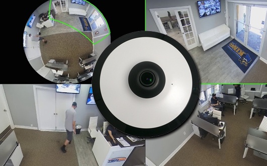
You may attempt to estimate camera and alarm placement but this is not always recommended unless you are knowledgeable about the law and surveillance and alarm systems as there is a lot to consider. For example the limitations on power and data streams change depending on the surveillance system your installing. Each camera has different distance and resolution limitations. It may be helpful to map power locations like outlets and circuit breakers but don’t stress too hard on these. With camera placement remember that both entrance and exit of every room, hallway, entryway and exit must receive coverage of the camera, and be able to identify the individual entering and exiting. Understand all disposal areas, processing areas, drying areas, grow areas, quarantine zones and essentially anywhere the product may be at any point, MUST to receive coverage. If you are doing an outdoor grow also note that the entire exterior fence line must receive coverage.
Here I’ve added a few videos for you to utilize as a guide lines. They pertain to how to search Google maps/Google earth and screen shot your image and paste it to paint so that you can use it for your floor plan. I’ve also made a few examples via Google Earth and paint for you to have a look at and reference. However you choose to tackle this issue just understand we are here to assist you as much as we can. We can help you turn a rough estimated floor plan into a compliant success story. The intent here is simply to put more control into your hands and speed you along the process!
Screenshoting a (Google Earth Image)